Tuesday, July 31, 2012

Big Sur

According to my co-workers, summer is the worst time to visit the coast of Northern California. Apparently it's foggy all the time and doesn't get very warm. I can confirm this is true.

I spent a Saturday driving to Big Sur and Monterey. I left early to avoid traffic, which was good in that I avoided traffic, but bad because the fog didn't clear up for a while.

Boats In The Mist


Highway 1 - partly foggy
I was bummed about the fog, but in the end it made for two different drive experiences along the same stretch of road so that was nice. The first stop was Julia Pfieffer Burns Beach which had been recommended to me by my co-worker Mauricio. It was very cool! There were rocks and water and waves through rocks! It's probably really amazing when you can see everything :)
View from the entrance
Getting to the beach requires driving 2 miles down a one lane road that is only sort-of marked off of Hwy 1. Mauricio's theory is that the residents take down the sign to keep people from finding it. If that's true, it's very sneaky.

Waving hello?

I stayed there for a bit, met some new dog friends, watched some people fish, then continued back north where it was getting sunnier. There are a ton of lookouts and stop offs along Highway 1. I stopped at a couple of the beaches before continuing on to Monterey.

One roadside beach


Fake Instagram filter photo


Friday, July 20, 2012

Local Bits

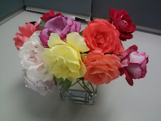
Just a small post on daily life. My internship is going well. The people I work with are great and the atmosphere is very relaxed. Even better, one of my coworkers has an insane rose garden and brings in flowers that sit on my shared desk! The flowers and landscaping out here are exceptional.


It's gotten a little better, but not much. This was our apartment the first week. You can see the school we overlook out of the sliding door (or as they say in Detroit, the doorwall.) Just take this photo, replace the frog chair with a normal sized one, add a coffee table and this is our main room :) Hello back to college.


Last one is a view from the path behind the apartment complex. There's a great bike path/trail that goes... I don't even know how many miles... From somewhere in San Jose to at least midway on Peninsula I think. You can see the golden hills back there!

Hetch Hetchy and the Poopenaut Valley

Sunday we decided to go to see Hetch Hetchy which is Yosemites sister valley that was flooded in 1923 to make a water reservoir for San Francisco and surrounding counties as well as generate electricity. Its existence is apparently still a bit controversial, and debate over its removal still occurs.


There's a giant lake and you can't swim in it. So sad. (Especially since it was over 90 degrees that day)

View of the valley plus dam spray... should I be making an inappropriate joke here?


There was also a fun tunnel which we totally made creepy gargoyle statues in. I need to get those photos from Hannah.


Overall Hetch Hetchy was interesting, but not a must-see. Unless you count taking a picture with the Poopenaut Valley sign. That was pretty great. (again, need to get the photo. Will update once obtained!)

The not 4 mile 4 mile trail

I made it to Yosemite National Park! It was so beautiful. I would come back here to spend a week, even if it is crazy busy. Having not booked a campsite earlier in the year we weren't in Yosemite Valley itself, we were in the northeastern part of the park at Tuolumne Meadows. The campground was really nice and, being across from a meadow, you could see sooo many stars. The bath house was even a cute 1940s cabin style.

Hannah, her brother Andy, and I only had one weekend (ugh, work.) so we couldn't go on too many trails. We elected to start with 4-Mile trail which goes from Yosemite Valley to Glacier Point, a major lookout over the park. The plan was to potentially then take Panorama Trail back because it would cover a different area.

I probably should have done a better research job because 1) 4 Mile trail is actually about 5 miles and 2) it was the steepest trail in the park. It was named 4 Mile trail after the original distance; they elongated the trail to make it less steep. Ugh.

But, it was a incredible hike so I'm not too upset that my legs hurt the next day. Aside from my being a bit out of shape, the elevation was a little tricky. The trail switchbacked along the mountainside overlooking Yosemite Falls. It went from this height:


To this height:


Ok they look pretty similar. Whatever, it was great!

You then swiched to the other side of the mountain to overlook Half Dome (which we did not go up as you need a permit and it probably would have killed me.)


Once at the top the view was amazing! It seriously didn't look real. Like it was a painted backdrop behind the overlook wall.


And there were squirrels trying to get our snacks.


The slightly depressing part was that you can drive to Glacier Point as well as hike so we were quite sweaty and gross while most people were all nice and neat. Including the wedding party. But it's ok, we had a nice sense of accomplishment and didn't have to be in the car anymore!


By the time we were done at Glacier Point it was too late in the day to attempt Panoramic Trail in case we were slow, so we just went back down 4 Mile. AND WE SAW BEARS! There was a mom and two cubs visible but still far enough back on the trail that I didn't think I'd get attacked. The cubs were playing around on a log then the three of them started digging at a tree stump. Seriously cute little buggers. This fulfilled one of my top 5 in-the-wild must see animals. (The others are whales, sea turtles, a wild cat of some type, and African. I'm lumping a safari as one... much easier that way)

I of course decided to leave my zoom lens at the campsite.


Yosemite Valley

4 Mile trail
Yikes.